 Hawksbill Mountain Summit
[Suggest Edits]


 36 votes
Description
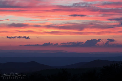
Getting to the summit of Hawksbill Mountain will require some effort, but for the intrepid explorers who make the journey, the rewards are one of a kind. The summit is the highest point in the park, and from the top, unobstructed views of the Shenandoah Valley abound, though, on some summer days, smog and air pollution from neighboring cities may limit the visibility from the peak.
Take your time to take in the views from here, and enjoy a picnic in Byrd’s Nest #2, one of the many shelters constructed by senator Harry Byrd. The stone shelter is a scenic spot, and visitors won’t want to miss having a snack, or taking a short rest in or around the structure. Take in the scenery, enjoy the northern forests, and keep a look out for the Shenandoah Salamander, a unique and fiery orange inhabitant of the summit!
While on the summit, visitors will enter a unique ecosystem. Boreal forests cover the top of the peak, and the balsam fir and red spruce inhabiting the area are uniquely suited for cool, wet environments such as those found in New England. These species have adapted specially to this summit and are therefore fragile. Please treat them with respect!
A picnic at the Byrd's Nest in conjunction with the views from the summit make a visit to Hawksbill an unforgettable experience for everyone from day trippers to AT through-hikers. You're not likely to enjoy a better view of the Shenandoah Valley anywhere else!
Short Run: Visitors have many options to reach the summit, all of which involve a bit of running. A mile-long trip is possible via the Hawksbill Trail/Byrds Nest #2 Road, or the more strenuous Salamander Trail. Visitors looking for a longer journey can take the Upper Hawksbill Trail, or can start from the Hawksbill Gap, and ascend via the Lower Hawksbill Trail.
Gem Type: Viewpoint
Nearby Gems
Nearby Trails
|
8.9
mi
14.3
km
Old Rag Loop
Stanley, VA


|
Stanley, VA |

|
295


|
||
|
8.2
mi
13.1
km
Whiteoak Canyon to Cedar Run Loop
Stanley, VA


|
Stanley, VA |

Unknown
Update
|
145


|
||
|
3.8
mi
6.1
km
Rose River Loop
Stanley, VA


|
Stanley, VA |

Unknown
Update
|
83


|
||
|
2.6
mi
4.2
km
Hawksbill Mountain Loop
Stanley, VA


|
Stanley, VA |

Unknown
Update
|
64


|
||
|
1.7
mi
2.7
km
Dark Hollow Falls
Stanley, VA


|
Stanley, VA |

Unknown
Update
|
66


|
||
|
1.1
mi
1.8
km
Bearfence Loop Trail
Stanley, VA


|
Stanley, VA |

Unknown
Update
|
57


|
||
|
5.5
mi
8.9
km
Little Devil Stairs Loop
Washington, VA


|
Washington, VA |

|
39


|
||
|
0.5
mi
0.8
km
Stony Man Trail
Stanley, VA


|
Stanley, VA |

|
37


|
||
|
5.0
mi
8.0
km
Whiteoak Canyon
Stanley, VA


|
Stanley, VA |

|
29


|
||
|
3.7
mi
5.9
km
Ridge Trail
Stanley, VA


|
Stanley, VA |

|
19


|

 Continue with onX Maps
 Sign in with Facebook


0 Comments